Panoramic View - Best viewed on a Laptop/Desktop

John Oxley Explorer - 1818 - Bathurst to Tamworth then Port Macquarie
The Innovate Aptitudes of Governor Macquarie, Explorer John Oxley, Pioneers, Settlers and Convicts developed Australia towards how it is today and the way we live today. We owe them the admiration they deserve.
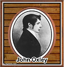
John Oxley, Explorer and NSW’s Surveyor-General, is regarded as an important identity in the early days of Colonial Australia. Much of western and northern NSW (including the Manilla/Tamworth District) owes its white settlement development to the explorations of John Oxley and his team.
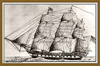
Prior to arriving in Sydney in 1812 John entered the (England) Royal Navy at age 15, retired from the Navy 10 years later, travelled to Sydney in the naval vessel “The Buffalo,” and was appointed Surveyor-General for NSW in 1812, at age 27. At this time Sydney’s population was approximately 5000 people.
A sketch of the Buffalo by passenger Mr Y. B. Hutchinson

The Governor of NSW was Lachlan Macquarie and his efforts encouraged exploration further west of Sydney.
It had to be - as a combination of drought, insect plagues, and the soil running out of nutrient in the Sydney district, meant finding fresh fertile pastoral land and fresh water in inland Australia were imperative for the survival of the Australian colony.
But firstly - a way over the Blue Mountain had to be found to facilitate this development.
The crossing over the difficult Blue Mountains would be a challenge as, at this stage, it formed a barrier to the westward expansion of the new colony.

In 1813, Governor Macquarie sent Blaxland, Wentworth and Lawson to find a way to cross the Blue Mountains. They took with them four convicts, four pack horses and four dogs and James Burns, as he was a settler who knew a lot about the bush and its Aboriginal pathways. They crossed in three weeks and reached the fertile plains of the Bathurst region. Burns recorded, “There before him, the first white man to see two thousand miles of fair pasture lands with limitless plains and open grassy forests.” A revelation one might say.
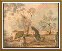

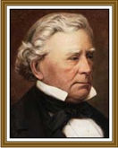
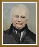
Gregory Blaxland Farmer
William Wentworth Explorer
William Lawson Surveyor
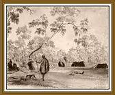
Prior to this the local Gundungurra, Dharawal, Wiradjuri, Wanaruah, Darug and Darkinjung peoples used two main routes to cross the Blue Mountains.


After Blaxland, Wentworth and Lawson returned, Governor Macquarie sent surveyor George Evans to survey their route for the construction of a road. In those days they measured with chains and steel bands and made complex mathematical computations using logarithmic tables and slide rules. George took two free men, and three convicts with him.
George Evans

Surveyors Mathematic Equations
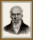
William Cox
On George’s return, Governor Macquarie then instructed a builder for the road - a bloke by the name of William Cox - who was also assisted by two Aboriginal men: Colebee from the Darug Tribe and the Boorooerongal Clan and Joe from the Mulgoa Clan.

Colebee
Plus, a team of 30 convict workers, thirty artificers (skilled craftsmen) and labourers and the guard of eight soldiers. Ably assisted with provisions and tools, two new carts with harness, and two yokes of well broken in bullocks (castrated young bulls).


Convicts escaped the dread of everyday life in the populated areas of the Colony and ate when their “masters” ate. On their return they faced the opportunity of receiving pardons and in some cases land grants.
The building of the road would start at Emu Plains and completed at the Macquarie River in the Bathurst plains region.
William’s instructions were that the road must be at least twelve feet wide, so as to permit two carts or other wheel carts to pass each other with ease, the timber in the forest ground to be cut down and cleared away 20 feet wide, grubbing up the stumps and filling the holes, so that a four-wheel carriage or cart may pass without difficulty of danger. And the brush ground to be cut twenty feet wide and grubbed up to twelve feet wide.
During 1814-1815, William Cox’s team took six months to complete the construction of the 160 kilometres of roadway. It was a great engineering feat for that time in history. The road was constructed by hand with primitive hand tools. Gelignite wasn’t introduced until decades later.
Shortly after Cox finished the road, Governor Macquarie visited the Bathurst Plains and selected a suitable site for the establishment of a town - named Bathurst.
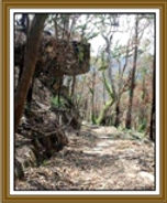
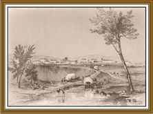
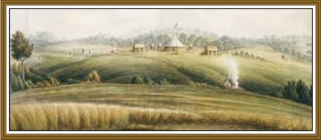
The founding of Bathurst in the early days
Free settlers finally began to travel to Bathurst around 1818 and found the road built by Cox a difficult and dangerous passage. The pass down Mt York, with its 1:4 grades, especially presented awesome difficulties to travellers with heavy drays and had to be braked by dragging large logs behind them as they headed downhill.
Original road to Bathurst
This difficulty was rectified when fifteen years later the Victoria Pass was built, a major improvement from the original, between 1830 and about 1838, carried out by chain gang convict labour and again, built by hand. The Causeway now has heritage status. The Victoria Pass improvement made life easier to travel westward.

Old Bathurst Road

New Bathurst Road
It was only after the road was built over the Blue Mountains in 1815 that John Oxley was asked by Governor Macquarie to explore the western region of NSW making his way up to the Liverpool Plans and the Peel District (Tamworth).
John Oxley departed from Bathurst on 28th May 1818 with an exploration party that included, Mr Evans Assistant, C. Fraser Botanist, P. Burne Huntsman, James Williams Smith, William Meggs Butcher, Simpson, J. Blake, J. Warner, Mr Oxley’s man, F. Lloyd, Mr Oxley’s man, R. Kippas Rough Carpenter, R. Watts Labourer, Thos Ellis Labourer, Thos Cribb Labourer, John Dwyer Boat Builders Boy.

There were also twelve convict men, 2 dozen horses, a botanist, minerologist, boat builder, boatman, sailor, horse shoer, butcher, horse leader, harness mender and a personal assistant. It was an arduous task and they were prepared for it.
Crossing a flooded river
The convict men were William Warner, Patrick Byrne, James Blake, George Simpson, James Williams, John Williams, Francis Lloyd, Barnard Butler, Thomas Ellis, John Dwyer, Richard Watts, Henry Shippey. On their return, Governor Macquarie thanked the men on their steady good and obedient conduct and gave them Conditional Pardons as a reward for their good behaviour.
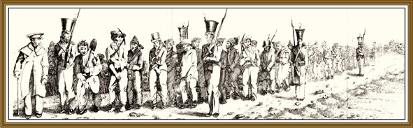
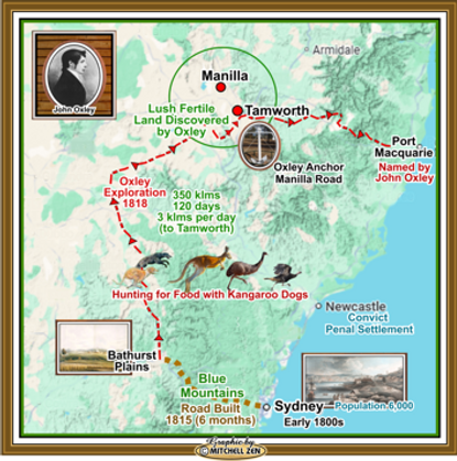
Oxley firstly ventured north along the Castlereagh River, and then across to the Liverpool Plains and onward to the Peel River, arriving on the 26th August 1818; near where the town of Tamworth is now located.
On arrival his diary notes read:
"It would be impossible to find a finer or more luxuriant country. No place in this world can afford more advantages to the industrious settler than this extensive vale. North and south, it is certainly not less than 60 miles (100 klms). It is well watered independently of the river, the grass most luxuriant, the timber good.”
The river was named Peel's River, in honour of the Right Hon. Robert Peel. Manilla is 45 kilometres from Tamworth and distinctly within John Oxley’s observations of fertile land.
Squatters began to arrive and a private village developed on the western bank of the Peel River in the late 1830s, with a few huts and stores on the eastern bank to cater for teamsters who crossed the river at that point.
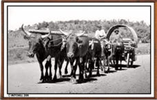
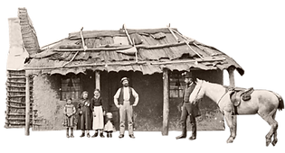
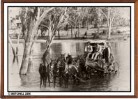
A lock-up was established and a postmaster employed in 1840, a survey for a townsite was carried out in 1849, Tamworth was gazetted in 1850 and by 1851 the population was 254, and a school was set up.
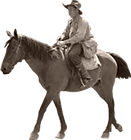
By 1866 Tamworth’s population was around 650. Manilla’s population was about 50 and grew to 285 in 1891 and nearly 900 by 1901. In the 1850s there was no settlement at Manilla – just a district divided up into large properties, where people lived in isolation.
In the early days of the Manilla district, around the 1820s, the names of some of these early settlers were: Baldwin, Hall, Brown, Bell and Pringle. It wasn’t until the 1850s that George Veness named Manilla, after arriving in Australia in 1849.
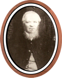

Matthew Hall
George Veness


This was the start of positive and productive development in this region. The fertile land was able to facilitate the production of wheat, beef cattle and sheep, creating a vast food and clothing industry that fed and clothed the increasing Australian population, and an export trade that boomed over the years – creating an economy that benefited Australia and the Manilla District. It also created the growth of other industries that helped with this advancement.
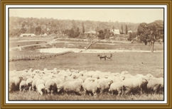
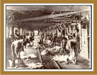

It is a testament to Oxley and his team’s exploration in 1818, where we should be forever grateful for their successful fortitude and accomplishments.
Near Tamworth, north on the Manilla Road, an anchor - the HMRN Survey Ship Sealark - commemorates the route taken by Lieutenant John Oxley and marks the spot where Oxley crossed the Peel River in 1818.

Following this discovery, Oxley continued, venturing east towards the Great Dividing Range, crossed it, found the Hastings River and on arrival named the town of Port Macquarie.
Whilst on this arduous exploration Oxley took notes and consistently wrote in his diary.
The following is just one observation of the indigenous population he uncounted along the way:
“A small tribe of natives, consisting of eight men arrived. They did not appear any way alarmed at the sight of us, but came boldly up. They were very stout and manly, well featured, with long beards and some were covered with cloaks made of possum skins; their faces daubed with a red and yellow pigment, with neatly worked nets bound round their hair. Their appearance was most miserable, their features approached deformity, and their persons were disgustingly filthy; their small attenuated limbs seemed scarcely able to support their bodies. The front tooth in the upper row was wanting in them all and they were unarmed, having nothing with them but their stone hatchets. Two youths not exceeding twenty years of age, were most horribly marked by the skin and flesh being raised in long stripes all over the back and body. Some of those stripes were full three-quarters of an inch deep, and were so close together that scarcely any of the original skin was to be seen between them.”

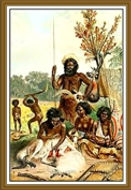


This 350klms plus exploration was difficult for Oxley and his team. Lack of water and food caused the horses and dogs to suffer, and go without water for 48 hours at times. Some died from these difficult bush travel conditions. One horse lost the use of his hind quarters and had to be shot. Kangaroo dogs were an asset as they hunted kangaroos, emus and wild turkeys for food. Other food were snakes and fish. Trees had to be felled to cross flooded rivers and this was met with failure on many occasions.

Oxley travelled on a number of other inland expeditions where he was assisted by “Billy” Broughton, an indigenous guide and cultural advisor, playing a crucial role in navigating the Australian landscape for Oxley, including identifying resources and potential routes.
Broughton (1798-1850), whose traditional name was Toodwik or Toodwit, from the Dharawal people - located in the Shoalhaven Region of NSW.
Billy also assisted Charles Throsby (English surgeon, explorer, pioneer and parliamentarian) in leading the expedition to find a suitable path from Campbelltown through the mountains and down to the coast at Jervis Bay. Broughton, with another guide called Bundel, led the group through Gandangara country to Bundanoon and Marulan, before descending along Bundanoon and Yarrunga Creeks into what is now known as the Kangaroo Valley. They then crossed the Shoalhaven River at Burrier and followed the Currambene Creek to Jervis Bay.
Billy also assisted Charles Throsby (English surgeon, explorer, pioneer and parliamentarian) in leading the expedition to find a suitable path from Campbelltown through the mountains and down to the coast at Jervis Bay. Broughton, with another guide called Bundel, led the group through Gandangara country to Bundanoon and Marulan, before descending along Bundanoon and Yarrunga Creeks into what is now known as the Kangaroo Valley. They then crossed the Shoalhaven River at Burrier and followed the Currambene Creek to Jervis Bay.
John Joseph William Molesworth Oxley - 1784 – 1828

Oxley had three daughters out of wedlock and in 1821, married Emma Norton. One of his daughters Louisa Oxley, aged four years, fell into a well 100 feet deep, under the Hyde Park Barrack wall, and was drowned before aid could be afforded.
John Oxley suffered with illness throughout his service, caused by the difficulties of his expeditions. He finally succumbed to his illness and died on the 25th May 1828 at his Kirkham property (Camden). He was 44 years of age.
His widow and children were granted 2,023 hectares (5,000 acres) by the Executive Council, although she was refused a pension.The house was demolished in 1882; the heritage-listed stables, which date from 1816, are all that remain.
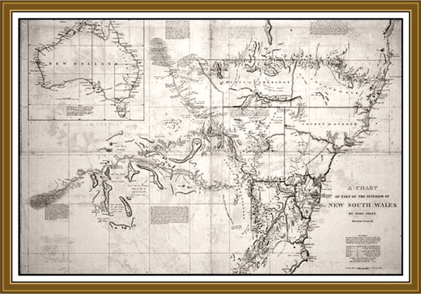
Oxley's 1822 Map of NSW